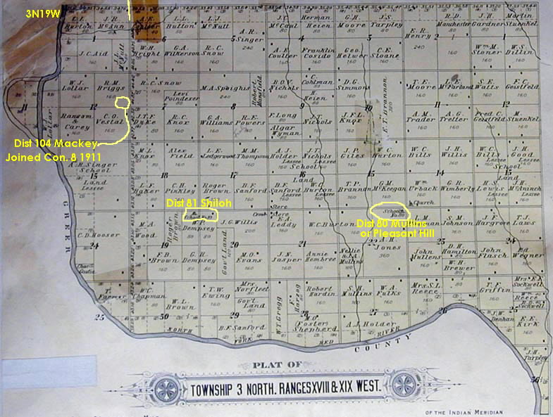
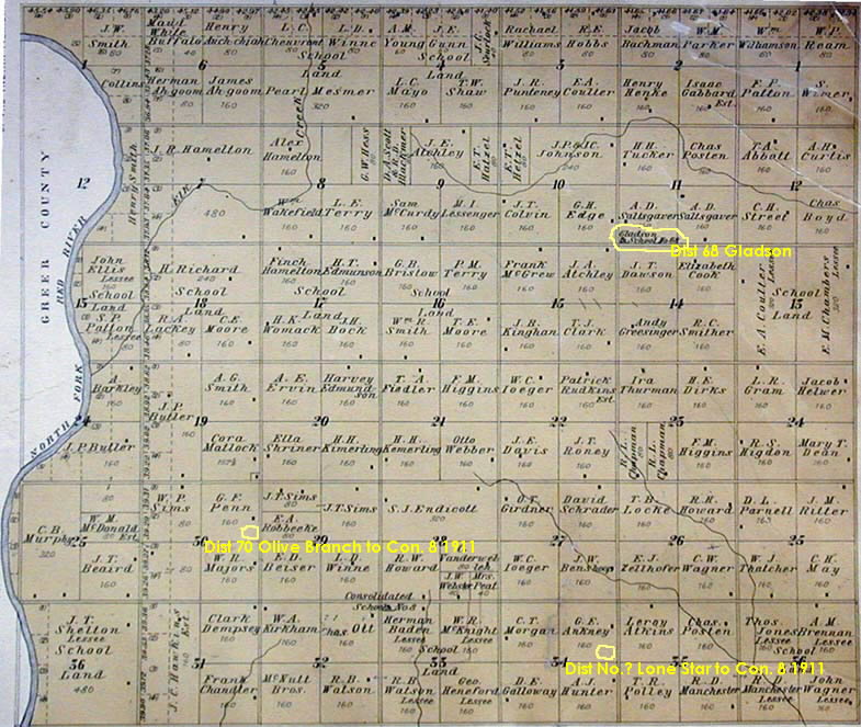
1913 Plats of some of Con. 8 Area
showing Owners and Lessees
A very elaborate Plat Book for Kiowa
County was published in 1914. At the bottom of this page are links to
photographs of two of the pages in this atlas, made from one of the two copies
which are in the office of the Kiowa County Clerk. The ownership and lessees of school land
are from 1913 postings. The maps also
show the positions of schools and the residence structures on the land. This latter information appears to be based
on data that in some cases is a year or two older than that. One has to look carefully to see the little
black rectangles showing the positions of the houses.
These two pictures show most of the final Con. 8 area,
although at the time Gibson, Shiloh, and Mullins which
are shown were serving portions of the area.
Three early schools Mackey, Lone
Star, and Olive Branch are not shown on the original map, as they were disbanded
when Con. 8 was first formed in 1911. I
have indicated positions of those former
schools with annotations in yellow.
(1)
3N/18 W and that part of 3N/19 W lying east of the river. Extends from the river on the south to 1 mile
south of present highway 19.
(2) 4N/18 W and that part of 4N/19 W
lying east of the river. Extends
north from 1 mile south of present highway 19 to the “correction line”.